History of Williamson Road
Williamson Road, Roanoke, VA
“Every town has a strip. Williamson Road is Roanoke’s strip – of which we are truly proud.”
Williamson Road – Early Days of Growth
Credit to “Williamson Road: Roanoke’s Historic Strip”, article by Brenda McDaniel, June 30, 2016 published in The Roanoker Magazine
Origins & Early Settlement
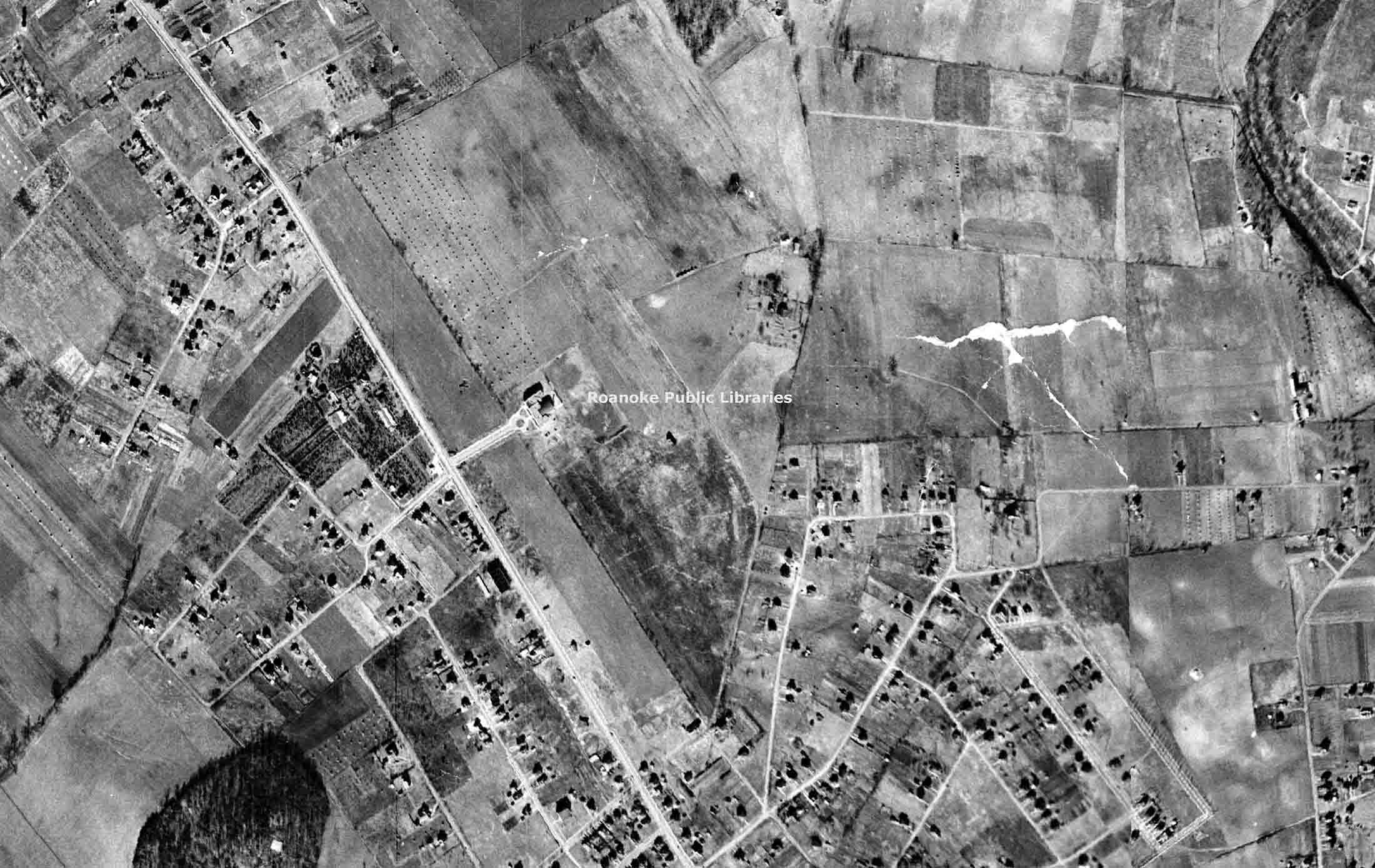
The land through which Williamson Road now passes was settled in the first half of the 18th century by pioneers moving down what was called “The Great Road” from the northeast into Virginia and North Carolina.
Until the 1850s the area remained largely rural, in large farms held by a relatively few families: names like Evans, Watts, Breckinridge, Reads, Garsts, Harshbargers, and Moomaws.
There was no “Williamson Road” until 1912. What exists now as the corridor was preceded by just “Tenth Street” as the main road of consequence in that area.
In 1912, residents petitioned Roanoke County for a new road that would provide a better route into downtown Roanoke. Some residents donated land, machinery and funding; the state provided prison labor for construction. The road was named after the Williamson family’s farmland which was condemned via eminent domain to gain the right-of-way. (Interestingly, the family was reportedly not thrilled about losing their land or the forced naming of the road.)
The city of Roanoke annexed the area north of Orange Avenue in 1949, adding about 12 square miles and 16,000 people into the city.
Growth & Significance During the Automobile Age
According to the city’s “Williamson Road Area Plan” (2004), the real boom in development of the corridor happened post-WWII (between 1940 and 1960), when more than 3,500 lots in the area were developed. Factors: housing shortages, new mortgages, and the automobile.
In 1923, Williamson Road became part of the Lee Highway system connecting Washington D.C. and Bristol, Virginia. In 1932 it became part of U.S. 11, which at the time connected Upstate New York to New Orleans.
With the highway traffic came the classic “strip” amenities: motels, gas stations, drive-in restaurants, neon signage. For example: motels such as Roanoke Motor Lodge, Howard Johnson, Air Castle Court, Shangri La, Hitching Post, Big Oak. Restaurants & signs: Archie’s Lobster House, Biff Burger, Little Chef, Esso, Texaco, Pure dotted the road. By the 1960s, the corridor had the characteristics of a classic American cruising and drag-racing strip: “straight lines, abundant stoplights, drive-in restaurants (think ‘American Graffiti’).”
Decline & Revitalization
In the 1970s and 1980s the corridor began to decline. One major cause: travelers and motorists shifting to faster, more direct routes via the Interstate system (e.g., I-81, I-581). The heavy traffic that kept the motels, gas stations, drive-ins alive diminished. The corridor in the 1980s became “a wild ride” – the article notes adult businesses proliferated: porn shops, X-rated movie houses, strip joints, adult bookstores, tattoo parlors, massage parlors became the norm on the road. One resident/business-owner interviewed (Elizabeth Bowles) counted “28” adult businesses in the area at one point, prompting neighborhood action to block further decline.
The community response: formation of the Williamson Road Action Forum (WRAF) and later the business arm, the Williamson Road Area Business Association (WRABA), which continue to exist and advocate for the corridor today under the name GWRABA – The Greater Williamson Road Area Business Association.
The city, over the years, has (and continues) implemented a number of streetscape and infrastructure improvements: wider sidewalks, crosswalks, spruced-up intersections, redesigned storefronts, and traffic calming.
The continuance of this revitalization to the current day shows how design (streetscape), governance (business associations) and cultural heritage (events) can converge to reshape an historic corridor -- one in which the area’s businesses, owners, and residents can all take pride.
Establishment of the Greater Williamson Road Area Business Association

Fast-forward to the early 1980’s when the Williamson Road Area Business Association (then called WRABA) was established, and from there, the jump to May 24, 1993. On that date the Roanoke City Council adopted ordinance number 31427, establishing the Williamson Road Area Special Service District (SSD). The SSD was created to “provide additional governmental services not being offered uniformly throughout the entire City, included but not limited to, economic and business development and promotional activities intended to foster business retention, business recruitment; planning for the development or revitalization of the Williamson Road Area for its transportation needs and to create a more attractive environment in the Williamson Road area.”
As a result of Ordinance #31427, WRABA signed an agreement with the City of Roanoke for the administration of the SSD project. The SSD provides for the collection of an additional ten cents per one-hundred-dollar valuation ($.10 per $100) of real estate on Williamson Road between Orange Avenue and the city limits, traveling north.
On March 15, 2021, the City Council amended and reordained the Williamson Road Area Service District to include “the area shown as designated on a map entitled “Official Map of Williamson Road Area Service District”” effective July 1, 2021 designated as Project Number 6860, and Project Number 6860-2 prepared and maintained in electronic format by the Office of the City Engineer. This expansion also increased the revenue estimate for the Williamson Road Area Service District Tax for FY22 by $156,511, increasing by the same amount the appropriation to the Williamson Road Area Business Association. Total tax to be received is estimated to be $258,511 yearly.
As a result of Ordinance #31427, WRABA signed an agreement with the City of Roanoke for the administration of the SSD project. The SSD provides for the collection of an additional ten cents per one-hundred-dollar valuation ($.10 per $100) of real estate on Williamson Road between Orange Avenue and the city limits, traveling north.
News & Updates

Meet our Board & Staff
Board of Directors
Staff

Williamson Road and You: Partners in Progress
Office
Located At:
5301 Williamson Rd.
Suite B
Roanoke, VA 24012
Mailing Address:
PO Box 7082
Roanoke, VA 24019
540-362-3293
Every town has its main “strip” – Williamson Road is Roanoke’s. At the intersection of community and business, it is a true microcosm of the world, with its many international restaurants and businesses.
Copyright © 2025 Greater Williamson Road Area Business Association